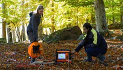
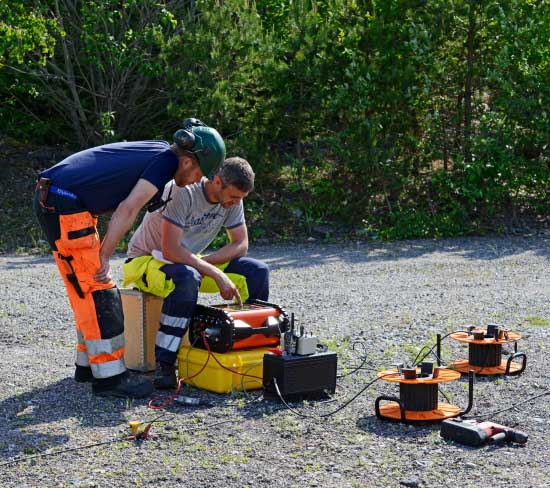
Seismic methods are commonly used for civil engineering and infrastructure studies, where data can easily be compared with complementary geotechnical surevying solution methods for determining depth to bedrock, bedrock quality, soil stability, finding fractures and weak zones, as well as more traditional geological mapping. The seismograph is triggered by ground vibrations created by an energy source. Time is then recorded accurately until these vibrations have propagated through the ground and can be measured by geophones connected to the seismograph.
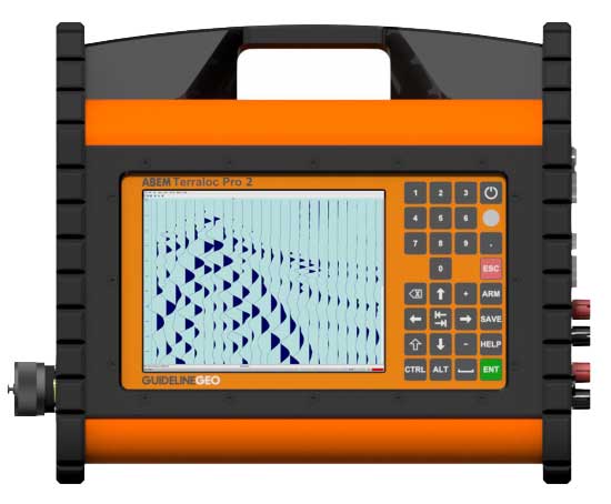
This can be configured with up to 48 channels in one unit, allowing for many sensors, creating a versatile geograph instrument capable of collecting high resolution data. If more channels are needed, several units can be connected. The cutting edge technology in the design of the measuring channels gives outstanding resolution of the measured signal both in terms of time and amplitude. The result is incomparable data quality across the instruments exceptional dynamic range.
Features
- Built-in computer
- 12, 24 or 48 measurement channels
- WiFi, Ethernet, USB and VGA connectivity
- 100 GB storage unit
- 2D and 3D measurements
- Sunlight visible LCD with graphical user interface
- Up to 480 000 samples and 80 minutes record length
- Military grade connectors
- High quality cables and accessories
Applications
- Depth to bedrock
- Soil stability
- Geological sequences and structures
- Rock quality
- Rippability
Advantages
- Designed for outstanding data quality
- Graphical user interface with a familiar feel
- Standalone system makes it easy to operate in the field
- Quality control before and during measurements
- Rugged and robust, do measurements anywhere, anytime
- Georeferenced data using GPS
- Possible to conduct any type of seismic method